Category:Area highlighted maps
From Bulbagarden Archives
Jump to navigationJump to search
These are maps of regions highlighting an area.
Media in category "Area highlighted maps"
The following 200 files are in this category, out of 987 total.
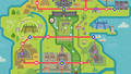
(previous page) (next page) Galar Courageous Cavern Map.png 960 × 489; 749 KB
 Galar Crown Shrine Map.png 1,280 × 635; 900 KB
 Galar Dappled Grove Map.png 1,920 × 1,080; 478 KB
 Galar Dusty Bowl Map.png 1,920 × 1,080; 506 KB
 Galar Dyna Tree Hill Map.png 1,280 × 643; 846 KB
 Galar East Lake Axewell Map.png 1,920 × 1,080; 478 KB
 Galar Fields of Honor Map.png 960 × 489; 767 KB
 Galar Forest of Focus Map.png 960 × 489; 751 KB
 Galar Freezington Map.png 1,280 × 628; 932 KB
 Galar Frigid Sea Map.png 1,280 × 643; 948 KB
 Galar Frostpoint Field Map.png 1,280 × 625; 925 KB
 Galar Galar Mine Map.png 1,920 × 1,080; 505 KB
 Galar Galar Mine No. 2 Map.png 1,920 × 1,080; 505 KB
 Galar Giant's Bed Map.png 1,280 × 633; 950 KB
 Galar Giant's Cap Map.png 1,920 × 1,080; 505 KB
 Galar Giant's Foot Map.png 1,280 × 597; 899 KB
 Galar Giant's Mirror Map.png 1,920 × 1,080; 506 KB
 Galar Giant's Seat Map.png 1,920 × 1,080; 477 KB
 Galar Glimwood Tangle Map.png 1,920 × 1,080; 503 KB
 Galar Hammerlocke Hills Map.png 1,920 × 1,080; 494 KB
 Galar Hammerlocke Map.png 1,920 × 1,080; 495 KB
 Galar Honeycalm Island Map.png 960 × 485; 744 KB
 Galar Honeycalm Sea Map.png 960 × 479; 740 KB
 Galar Hulbury Map.png 1,920 × 1,080; 507 KB
 Galar Iceberg Ruins Map.png 1,280 × 686; 1,007 KB
 Galar Insular Sea Map.png 960 × 484; 763 KB
 Galar Iron Ruins Map.png 1,280 × 687; 1.01 MB
 Galar Lake of Outrage Map.png 1,920 × 1,080; 506 KB
 Galar Lakeside Cave Map.png 1,280 × 609; 793 KB
 Galar Loop Lagoon Map.png 960 × 486; 755 KB
 Galar Max Lair Map.png 1,280 × 687; 1,018 KB
 Galar Meetup Spot Map.png 1,920 × 1,080; 462 KB
 Galar Motostoke Map.png 1,920 × 1,080; 516 KB
 Galar Motostoke Outskirts Map.png 1,920 × 1,080; 516 KB
 Galar Motostoke Riverbank Map.png 1,920 × 1,080; 515 KB
 Galar North Lake Miloch Map.png 1,920 × 1,080; 477 KB
 Galar Old Cemetery Map.png 1,280 × 634; 947 KB
 Galar Path to the Peak Map.png 1,280 × 610; 831 KB
 Galar Postwick Map.png 1,920 × 1,080; 470 KB
 Galar Potbottom Desert Map.png 960 × 489; 769 KB
 Galar Roaring-Sea Caves Map.png 1,280 × 633; 935 KB
 Galar Rock Peak Ruins Map.png 1,280 × 688; 1.01 MB
 Galar Rolling Fields Map.png 1,920 × 1,080; 477 KB
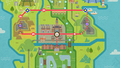
 Galar Route 1 Map.png 1,920 × 1,080; 472 KB
 Galar Route 10 Map.png 1,920 × 1,080; 506 KB
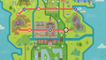
 Galar Route 2 Map.png 1,920 × 1,080; 471 KB
 Galar Route 3 Map.png 1,920 × 1,080; 516 KB
 Galar Route 4 Map.png 1,920 × 1,080; 507 KB
 Galar Route 5 Map.png 1,920 × 1,080; 507 KB
 Galar Route 6 Map.png 1,920 × 1,080; 495 KB
 Galar Route 7 Map.png 1,920 × 1,080; 495 KB
 Galar Route 8 Map.png 1,920 × 1,080; 503 KB
 Galar Route 9 Map.png 1,920 × 1,080; 504 KB
 Galar Route 9 Tunnel Map.png 1,920 × 1,080; 492 KB
 Galar Slippery Slope Map.png 1,280 × 645; 938 KB
 Galar Slumbering Weald Map.png 1,920 × 1,080; 469 KB
 Galar Snowslide Slope Map.png 1,280 × 634; 942 KB
 Galar Soothing Wetlands Map.png 960 × 489; 750 KB
 Galar South Lake Miloch Map.png 1,920 × 1,080; 478 KB
 Galar Spikemuth Map.png 1,920 × 1,080; 495 KB
 Galar Split-Decision Ruins Map.png 1,280 × 633; 938 KB
 Galar Stepping-Stone Sea Map.png 960 × 489; 768 KB
 Galar Stony Wilderness Map.png 1,920 × 1,080; 506 KB
 Galar Stow-on-Side Map.png 1,920 × 1,080; 503 KB
 Galar Three-Point Pass Map.png 1,280 × 629; 939 KB
 Galar Training Lowlands Map.png 960 × 489; 751 KB
 Galar Tunnel to the Top Map.png 1,280 × 632; 882 KB
 Galar Turffield Map.png 1,920 × 1,080; 508 KB
 Galar Warm-Up Tunnel Map.png 960 × 490; 792 KB
 Galar Watchtower Ruins Map.png 1,920 × 1,080; 478 KB
 Galar Wedgehurst Map.png 1,920 × 1,080; 471 KB
 Galar West Lake Axewell Map.png 1,920 × 1,080; 478 KB
 Galar Workout Sea Map.png 960 × 487; 765 KB
 Galar Wyndon Map.png 1,920 × 1,080; 520 KB
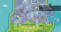
 Ginkgo Landing LA.png 1,280 × 720; 926 KB
 Golden.png 250 × 250; 10 KB
 Grand Sea Map.png 1,280 × 900; 1.97 MB
 Grapefruit.png 250 × 250; 10 KB
 Great Canyon Map.png 1,280 × 900; 1.97 MB
 Hamlin.png 250 × 250; 10 KB
 Haruba Desert Ranger2 map.png 256 × 192; 6 KB
 Haruba Village Ranger2 map.png 256 × 192; 6 KB
 Heights Ranger3 map.png 256 × 192; 6 KB
 Hia Valley Ranger2 map.png 256 × 192; 6 KB
 Hinder Cape Ranger3 map.png 256 × 192; 6 KB
 Hippowdon Temple Ranger2 map.png 256 × 192; 9 KB
 Hisui Aipom Hill Map.png 1,280 × 687; 1.1 MB
 Hisui Alabaster Icelands Map.png 1,280 × 720; 1.49 MB
 Hisui Ancient Quarry Map.png 1,280 × 687; 1.18 MB
 Hisui Ancient Retreat Map.png 1,280 × 720; 1.5 MB
 Hisui Arena's Approach Map.png 1,280 × 687; 1.24 MB
 Hisui Aspiration Hill Map.png 1,280 × 687; 1.16 MB
 Hisui Avalanche Slopes Map.png 1,280 × 687; 1.24 MB
 Hisui Avalugg's Legacy Map.png 1,280 × 687; 1.25 MB
 Hisui Bathers' Lagoon Map.png 1,280 × 687; 1.1 MB
 Hisui Bolderoll Ravine Map.png 1,280 × 687; 1.18 MB
 Hisui Bolderoll Slope Map.png 1,280 × 687; 1.18 MB
 Hisui Bonechill Wastes Map.png 1,280 × 687; 1.24 MB
 Hisui Brava Arena Map.png 1,280 × 687; 1.18 MB
 Hisui Castaway Shore Map.png 1,280 × 687; 1.1 MB
 Hisui Celestica Ruins Map.png 1,280 × 687; 1.18 MB
 Hisui Celestica Trail Map.png 1,280 × 687; 1.18 MB
 Hisui Clamberclaw Cliffs Map.png 1,280 × 687; 1.18 MB
 Hisui Cloudcap Pass Map.png 1,280 × 687; 1.17 MB
 Hisui Cloudpool Ridge Map.png 1,280 × 687; 1.18 MB
 Hisui Cobalt Coastlands Map.png 1,280 × 720; 1.5 MB
 Hisui Coronet Highlands Map.png 1,280 × 720; 1.5 MB
 Hisui Cottonsedge Prairie Map.png 1,280 × 687; 1.18 MB
 Hisui Crevasse Passage Map.png 1,280 × 687; 1.25 MB
 Hisui Crimson Mirelands Map.png 1,280 × 720; 1.49 MB
 Hisui Crossing Slope Map.png 1,280 × 687; 1.1 MB
 Hisui Deadwood Haunt Map.png 1,280 × 687; 1.1 MB
 Hisui Deertrack Heights Map.png 1,280 × 687; 1.16 MB
 Hisui Deertrack Path Map.png 1,280 × 687; 1.16 MB
 Hisui Diamond Heath Map.png 1,280 × 687; 1.17 MB
 Hisui Diamond Settlement Map.png 1,280 × 687; 1.18 MB
 Hisui Droning Meadow Map.png 1,280 × 687; 1.18 MB
 Hisui Fabled Spring Map.png 1,280 × 687; 1.18 MB
 Hisui Floaro Gardens Map.png 1,280 × 687; 1.16 MB
 Hisui Gapejaw Bog Map.png 1,280 × 687; 1.18 MB
 Hisui Ginkgo Landing Map.png 1,280 × 687; 1.1 MB
 Hisui Glacier Terrace Map.png 1,280 × 687; 1.24 MB
 Hisui Golden Lowlands Map.png 1,280 × 687; 1.18 MB
 Hisui Grandtree Arena Map.png 1,280 × 687; 1.16 MB
 Hisui Grueling Grove Map.png 1,280 × 687; 1.16 MB
 Hisui Heart's Crag Map.png 1,280 × 687; 1.24 MB
 Hisui Heavenward Lookout Map.png 1,280 × 687; 1.18 MB
 Hisui Hibernal Cave Map.png 1,280 × 687; 1.25 MB
 Hisui Hideaway Bay Map.png 1,280 × 687; 1.1 MB
 Hisui Holm of Trials Map.png 1,280 × 687; 1.18 MB
 Hisui Horseshoe Plains Map.png 1,280 × 687; 1.16 MB
 Hisui Ice Column Chamber Map.png 1,280 × 687; 1.25 MB
 Hisui Icepeak Arena Map.png 1,280 × 687; 1.24 MB
 Hisui Icepeak Cavern Map.png 1,280 × 687; 1.25 MB
 Hisui Islespy Shore Map.png 1,280 × 687; 1.1 MB
 Hisui Jubilife Village Map.png 1,280 × 720; 1.49 MB
 Hisui Lake Acuity Map.png 1,280 × 687; 1.24 MB
 Hisui Lake Valor Map.png 1,280 × 687; 1.18 MB
 Hisui Lake Verity Map.png 1,280 × 687; 1.16 MB
 Hisui Lava Dome Sanctum Map.png 1,280 × 687; 1.1 MB
 Hisui Lonely Spring Map.png 1,280 × 687; 1.18 MB
 Hisui Molten Arena Map.png 1,280 × 687; 1.1 MB
 Hisui Nature's Pantry Map.png 1,280 × 687; 1.16 MB
 Hisui Obsidian Falls Map.png 1,280 × 687; 1.16 MB
 Hisui Obsidian Fieldlands Map.png 1,280 × 720; 1.49 MB
 Hisui Oreburrow Tunnel Map.png 1,280 × 687; 1.16 MB
 Hisui Pearl Settlement Map.png 1,280 × 687; 1.24 MB
 Hisui Primeval Grotto Map.png 1,280 × 687; 1.12 MB
 Hisui Ramanas Island Map.png 1,280 × 687; 1.16 MB
 Hisui Sacred Plaza Map.png 1,280 × 687; 1.18 MB
 Hisui Sand's Reach Map.png 1,280 × 687; 1.1 MB
 Hisui Sandgem Flats Map.png 1,280 × 687; 1.16 MB
 Hisui Scarlet Bog Map.png 1,280 × 687; 1.18 MB
 Hisui Seagrass Haven Map.png 1,280 × 687; 1.1 MB
 Hisui Seaside Hollow Map.png 1,280 × 687; 1.1 MB
 Hisui Secret Hollow Map.png 1,280 × 687; 1.25 MB
 Hisui Shrouded Ruins Map.png 1,280 × 687; 1.18 MB
 Hisui Sludge Mound Map.png 1,280 × 687; 1.18 MB
 Hisui Snowfall Hot Spring Map.png 1,280 × 687; 1.24 MB
 Hisui Snowpoint Temple Map.png 1,280 × 687; 1.25 MB
 Hisui Solaceon Ruins Map.png 1,280 × 687; 1.18 MB
 Hisui Sonorous Path Map.png 1,280 × 687; 1.18 MB
 Hisui Spring Path Map.png 1,280 × 687; 1.1 MB
 Hisui Stone Portal Map.png 1,280 × 687; 1.17 MB
 Hisui Stonetooth Rows Map.png 1,280 × 687; 1.18 MB
 Hisui Temple of Sinnoh Map.png 1,280 × 687; 1.18 MB
 Hisui The Heartwood Map.png 1,280 × 687; 1.16 MB
 Hisui Tidal Passage Map.png 1,280 × 687; 1.1 MB
 Hisui Tidewater Dam Map.png 1,280 × 687; 1.16 MB
 Hisui Tombolo Walk Map.png 1,280 × 687; 1.1 MB
 Hisui Tranquility Cove Map.png 1,280 × 687; 1.1 MB
 Hisui Ursa's Ring Map.png 1,280 × 687; 1.18 MB
 Hisui Veilstone Cape Map.png 1,280 × 687; 1.1 MB
 Hisui Wayward Cave Map.png 1,280 × 687; 1.18 MB
 Hisui Wayward Wood Map.png 1,280 × 687; 1.18 MB
 Hisui Whiteout Valley Map.png 1,280 × 687; 1.24 MB
 Hisui Windbreak Stand Map.png 1,280 × 687; 1.1 MB
 Hisui Windswept Run Map.png 1,280 × 687; 1.16 MB
 Hisui Worn Bridge Map.png 1,280 × 687; 1.16 MB
 Hoenn Abandoned Ship Map.png 257 × 159; 4 KB
 Hoenn Altering Cave Map.png 257 × 159; 4 KB
 Hoenn Ancient Tomb Map.png 257 × 159; 4 KB
 Hoenn Battle Frontier Map.png 257 × 159; 4 KB
 Hoenn Battle Resort Map.png 320 × 210; 62 KB
 Hoenn Battle Tents Map.png 257 × 159; 6 KB
 Hoenn Desert Ruins Map.png 257 × 159; 4 KB
 Hoenn Desert Underpass Map.png 257 × 159; 4 KB
 Hoenn Dewford Town Map.png 257 × 159; 4 KB
 Hoenn Ever Grande City Map.png 257 × 159; 4 KB
 Hoenn Fallarbor Town Map.png 257 × 159; 4 KB
 Hoenn Faraway Island Map.png 257 × 159; 4 KB
 Hoenn Fiery Path Map.png 257 × 159; 4 KB
 Hoenn Fortree City Map.png 257 × 159; 4 KB
 Hoenn Granite Cave Map.png 257 × 159; 4 KB
 Hoenn Island Cave Map.png 257 × 159; 4 KB
 Hoenn Jagged Pass Map.png 257 × 159; 4 KB
 Hoenn Lavaridge Town Map.png 257 × 159; 4 KB
 Hoenn Lilycove City Map.png 257 × 159; 4 KB
 Hoenn Littleroot Town Map.png 257 × 159; 4 KB
 Hoenn Marine Cave Map.png 257 × 159; 12 KB


