File:Sevii Islands Four Island Map.png: Difference between revisions
From Bulbagarden Archives
Jump to navigationJump to search
(Map of the middle three Sevii Islands, highlighting Four Island for the Cities and Towns Bulbapedia Project. Created using MSPaint and a map of the Sevii Islands from FireRed/LeafGreen. {{i-PD-user|TTEchidna}}) |
No edit summary |
||
| Line 1: | Line 1: | ||
==Summary== | |||
{{Regionmap|Four Island (town)|Kanto|FRLG|Four Island}} | |||
==Licensing:== | |||
{{i-PD-user|TTEchidna}} | |||
Revision as of 04:42, 4 November 2009
Summary
| This is an in-game map of the Kanto region from Pokémon FireRed and LeafGreen, with Four Island highlighted. |
Licensing:
| This image has been released into the public domain by its creator, TTEchidna. This applies worldwide. | 
|
File history
Click on a date/time to view the file as it appeared at that time.
| Date/Time | Thumbnail | Dimensions | User | Comment | |
|---|---|---|---|---|---|
| current | 21:41, 29 September 2012 | 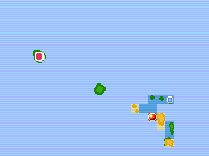 | 192 × 144 (1,016 bytes) | Lady Ariel (talk | contribs) | Animated |
| 09:47, 3 December 2006 |  | 192 × 144 (2 KB) | TTEchidna (talk | contribs) | Map of the middle three Sevii Islands, highlighting Four Island for the Cities and Towns Bulbapedia Project. Created using MSPaint and a map of the Sevii Islands from FireRed/LeafGreen. {{i-PD-user|TTEchidna}} |
You cannot overwrite this file.
File usage
There are no pages that use this file.
Global file usage
The following other wikis use this file:
- Usage on bulbapedia.bulbagarden.net