File:Sevii Islands Six Island Map.png
From Bulbagarden Archives
Jump to navigationJump to search
No higher resolution available.
Sevii_Islands_Six_Island_Map.png (192 × 144 pixels, file size: 1 KB, MIME type: image/png, looped, 2 frames, 0.7 s)
Note: Due to technical limitations, thumbnails of this file will not be animated.
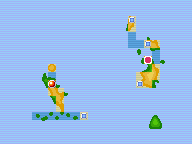
Map of the last three Sevii Islands, highlighting Six Island for the Cities and Towns Bulbapedia Project. Created using MSPaint and a map of the Sevii Islands from FireRed/LeafGreen.
| This image has been released into the public domain by its creator, TTEchidna. This applies worldwide. | 
|
File history
Click on a date/time to view the file as it appeared at that time.
| Date/Time | Thumbnail | Dimensions | User | Comment | |
|---|---|---|---|---|---|
| current | 20:01, 13 October 2012 | | 192 × 144 (1 KB) | Lady Ariel (talk | contribs) | Fixed location |
| 21:44, 29 September 2012 |  | 192 × 144 (1 KB) | Lady Ariel (talk | contribs) | Animated | |
| 10:00, 3 December 2006 |  | 192 × 144 (2 KB) | TTEchidna (talk | contribs) | Map of the last three Sevii Islands, highlighting Six Island for the Cities and Towns Bulbapedia Project. Created using MSPaint and a map of the Sevii Islands from FireRed/LeafGreen. {{i-PD-user|TTEchidna}} |
You cannot overwrite this file.
File usage
There are no pages that use this file.
Global file usage
The following other wikis use this file:
- Usage on bulbapedia.bulbagarden.net