File:Hoenn ORAS Map.png
From Bulbagarden Archives
Jump to navigationJump to search
No higher resolution available.
Hoenn_ORAS_Map.png (320 × 210 pixels, file size: 66 KB, MIME type: image/png)
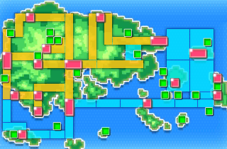
Summary
A map of Hoenn from Omega Ruby and Alpha Sapphire
Licensing:
| This image is a screenshot from a Pokémon game, or substantially derived from one. The contributor claims this to be fair use. | 
|
File history
Click on a date/time to view the file as it appeared at that time.
| Date/Time | Thumbnail | Dimensions | User | Comment | |
|---|---|---|---|---|---|
| current | 15:53, 27 November 2014 | | 320 × 210 (66 KB) | Pattyman (talk | contribs) | ==Summary== A map of {{bp|Hoenn}} from {{pkmn|Omega Ruby and Alpha Sapphire}} ==Licensing:== {{i-Fairuse-screenshot-game}} Category:Game maps Category:Hoenn maps Category:Town maps |
You cannot overwrite this file.
File usage
There are no pages that use this file.
Global file usage
The following other wikis use this file:
- Usage on bulbapedia.bulbagarden.net
- Bulbapedia:Sandbox
- Hoenn
- Underwater
- Nameless Cavern
- Pathless Plain
- Trackless Forest
- Gnarled Den
- Crescent Isle
- Fabled Cave
- Mirage Caves
- Mirage Forests
- Mirage Mountains
- Mirage Cave (south of Route 107)
- Mirage Cave (north of Fallarbor Town)
- Mirage Cave (west of Route 115)
- Mirage Cave (north of Fortree City)
- Mirage Cave (north of Route 124)
- Mirage Cave (southeast of Route 129)
- Mirage Cave (south of Route 131)
- Mirage Cave (north of Route 132)
- User:SnorlaxMonster/Hoenn
- Mirage Forest (west of Route 105)
- Mirage Forest (south of Route 109)
- Mirage Forest (north of Route 111)
- Mirage Forest (west of Route 114)
- Mirage Forest (north of Lilycove City)
- Mirage Forest (north of Route 124)
- Mirage Forest (east of Mossdeep City)
- Mirage Forest (south of Route 132)
- Mirage Island (west of Route 104)
- Mirage Island (west of Dewford Town)
- Mirage Island (north of Route 113)
- Mirage Island (north of Route 124)
- Mirage Island (north of Route 125)
- Mirage Island (south of Pacifidlog Town)
- Mirage Island (south of Route 132)
- Mirage Island (south of Route 134)
- Mirage Mountain (west of Route 104)
- Mirage Mountain (north of Lilycove City)
- Mirage Mountain (north of Route 125)
- Mirage Mountain (northeast of Route 125)
- Mirage Mountain (east of Route 125)
- Mirage Mountain (southeast of Route 129)
- Mirage Mountain (south of Route 129)
- Mirage Mountain (south of Route 131)